Memleben Abbey, located in Saxony-Anhalt at the confluence of the Unstrut and Saale rivers, was founded around 979 by Emperor Otto II and Empress Theophanu. It became a significant imperial Benedictine monastery under the Ottonian dynasty. Although now in ruins, archaeological investigations continue to shed light on its architectural and historical importance in early medieval Germany.
2008–2021 – Lehr- und Forschungsgrabungen under Dr Holger Grönwald (LDA Sachsen-Anhalt)
Between 2017 and 2021, field schools and excavations at the former abbey were directed by Dr Holger Grönwald, archaeologist at the Saxony-Anhalt State Office for Heritage Management and Archaeology (LDA Sachsen-Anhalt), with academic participation from the Martin-Luther-Universität Halle-Wittenberg and Albert-Ludwigs-Universität Freiburg. Funded by the LDA and the Stiftung Kloster und Kaiserpfalz Memleben, the team uncovered early Ottonian church foundations, mortar layers, and structural remains believed to be part of the royal chapel where King Henry I and Emperor Otto I died and were commemorated.
April–May 2024 – Discovery of medieval fortified settlement under Prof Dr Felix Biermann (LDA Sachsen-Anhalt)
From April 2 to May 2, 2024, excavations 1.2 km north of the Unstrut uncovered a previously unknown fortified settlement. Directed by Prof Dr Felix Biermann, scientific advisor at LDA and Professor of Early Medieval Archaeology, the campaign revealed a 240 × 170 m enclosed site including a single-nave stone church and large residential building. Artifacts included Slavic ceramics, coins, and pilgrim badges. The excavation was jointly funded by LDA and the Stiftung Kloster und Kaiserpfalz Memleben.
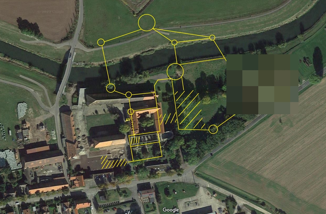
2024 – Geophysical survey and landscape mapping led by Prof Dr Felix Biermann
In parallel with the 2024 excavations, Prof Dr Felix Biermann oversaw geophysical prospections using GPR and magnetometry across the site. This survey mapped subsurface structures confirming the layout of the fortified settlement and associated ecclesiastical buildings. The work was supported by the LDA and regional heritage bodies.
2021 – Digital reconstruction initiative by LDA & Martin-Luther-Universität Halle-Wittenberg
In 2021, LDA working in collaboration with Martin-Luther-Universität Halle-Wittenberg conducted a digital reconstruction project of Memleben Abbey using 3D laser scanning and historical plans. Leadership names were not disclosed in public documentation, but the initiative involved heritage professionals and academic staff, supported by LDA and regional educational funding.
2021–2024 – Environmental and landscape archaeology (MLU & LDA)
Between 2021 and 2024, environmental archaeology—pollen analysis, soil profiling, and landscape study—was integrated into excavations led by LDA in cooperation with Martin-Luther-Universität Halle-Wittenberg. Although individual researchers are not named, geoarchaeologists and paleoecologists from MLU contributed to reconstructing the abbey’s agricultural practices and resource management. This research was funded by the German Research Foundation and regional heritage sponsors.
Summary
Archaeological research at Memleben Abbey, coordinated by the Saxony-Anhalt State Office for Heritage Management and Archaeology (LDA), has brought to light new dimensions of early medieval imperial religious architecture. Excavations directed by Dr Holger Grönwald and Prof Dr Felix Biermann revealed the foundations of a 10th-century church connected to Henry I and Otto I, and uncovered a previously unknown fortified medieval settlement. Geophysical surveys and environmental studies further enriched understanding of the site’s layout, resource infrastructure, and sacred context. These verified findings, supported by regional heritage bodies and university collaborations, provide fresh insight into Memleben’s significance during the Ottonian period.